
“It was estimated that approximately 20% of houses, more than 30% of commercial buildings, and the majority of critical infrastructure in the US Virgin Islands were vulnerable to flooding due to rainfall.”

Flooding event on the roads in Bovoni, St. Thomas. The Bovoni landfill can be seen in the background and is also vulnerable to pluvial flooding.
A lot of this vulnerability is caused by the fact that proper drainage has been hard to achieve on all three islands, for a variety of reasons including the threefold increase in population density, construction allowed in floodplain or alongside natural water courses (guts) and the lack of a database of drainage infrastructure in the Virgin Islands.

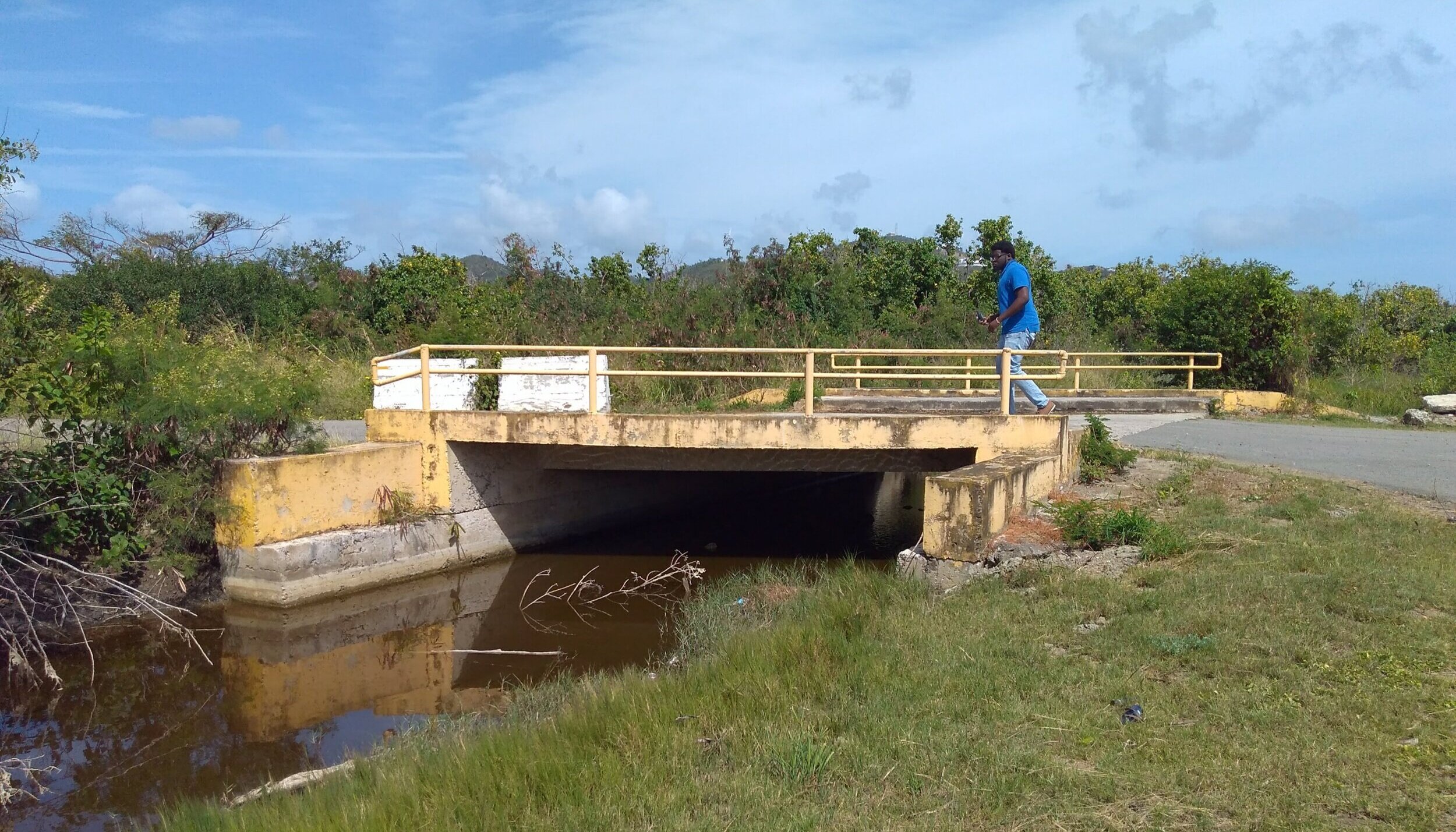
Image depicts a culvert that diverts water from the natural gut under the road
This project will produce two major results:
1. Produce the first geo-referenced database of the major drainage infrastructure components in the Virgin Islands.
2. Provide initial recommendations for storm water system improvements and the creation of a fast, safe and efficient drainage system for select locations.
Results will be summarized into a report to the Virgin Islands’ Water Resource Institute (WRI).
PRoject Objectives and METHODS
Develop geo-database (using ArcGIS) by collecting data in the field of the location and physical characteristics of major drainage infrastructure.
Collect data using a GPS, laser measuring tool and Survey123 app on the phone or ipad. Data gathered includes type, dimensions, route, documenting obstructions or overgrown regions, notes on the surrounding area and photos.
Provide initial recommendations for storm water system improvement in a few select locations
Share results with partner agencies to solicit feedback and train partners in using and updating the database.
Identify next steps and future needs.
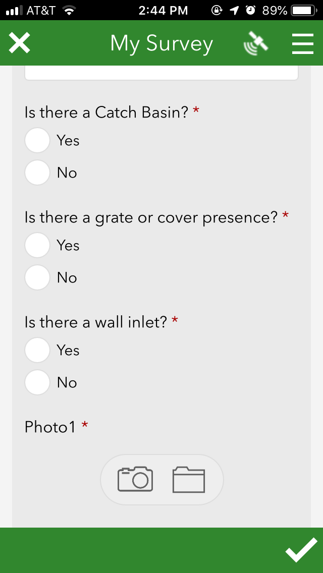
Example of Survey123

UVI Student Research
UVI students collect GPS coordinates and gather data on drainage systems in the Territory. This image shows a drainage channel and a culvert directing water under a bridge in Contant, St. Thomas.
Last Updated: October 2019