This is an interactive map of USVI Public Bin Sites.
Click on the icons to see observations and photos of the bin sites.
“The average Virgin Islander produces approximately 9 lbs. of trash per day - almost 40% above the U.S. average [1]. In the USVI residents often utilize public bin sites to throw away household trash. An average bin site in the Territory is expected to serve more than 7,500 residents and the average dumpster at that site serves 1,350 people [2]. Unfortunately, each dumpster, if emptied once daily, can only serve approximately 500 residents. This reality increases the pressure on the USVI’s two landfills: Bovoni landfill on St. Thomas and Anguilla landfill in St. Croix, which are already filled beyond capacity.”
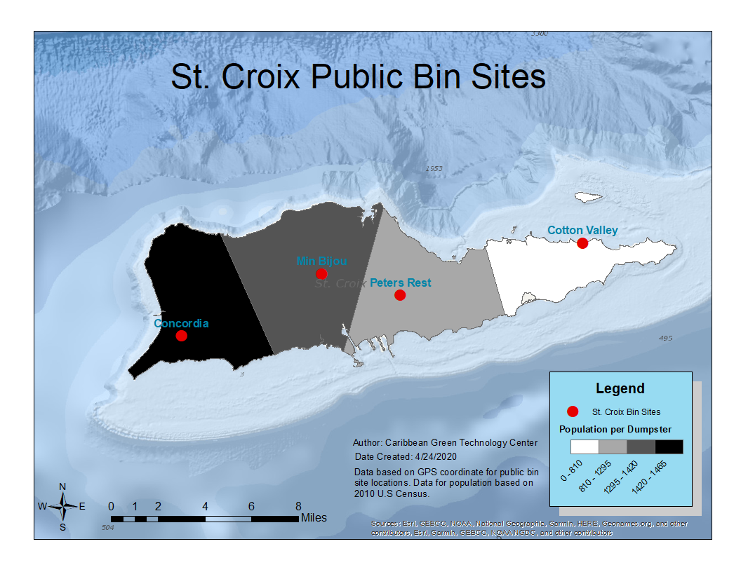
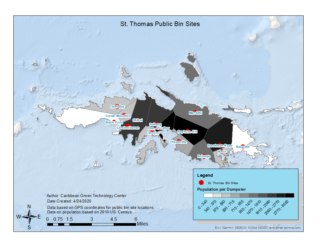
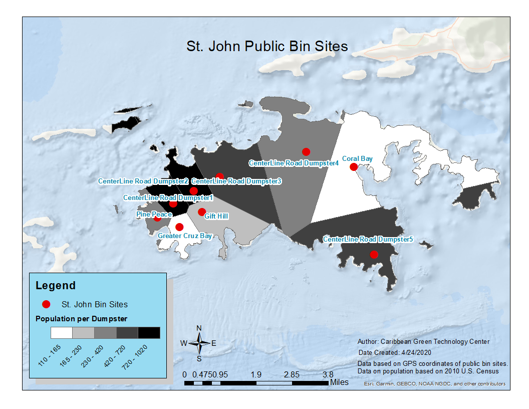
The maps below show the geographical area and population served by each public bin site and dumpster in the USVI [2][3].


[1] Estimate was calculated according to 2010 U.S. Census data and the results from a 2009 waste characterization study.
[2] Location of bin sites provided by VIWMA and CGTC data collection on GPS coordinates. The population served was calculated with 2010 U.S. Census block data and with the assumption that each resident travels the shortest distance geographically to dispose of waste (See maps above). This has limitations as it does not consider roadway routes and indirect paths taken by residents. Additionally, it does not consider the 14,000 residents served via door-to-door pickup.
[3] On St. John the Centerline Road dumpsters were smaller than the estimated 20 cubic yards so population per dumpster is larger than actual population.

